
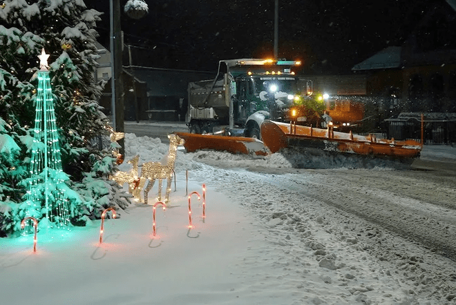
A winter storm swept across parts of the Midwest, Northeast and Mid-Atlantic, snarling traffic heading home after the Christmas holiday. During heavy congestion, the storm snarled traffic across major highways, leaving drivers stuck for hours.
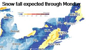
The snarled traffic stretched for miles as snow continued to fall. Holiday travelers faced snarling traffic conditions from Massachusetts to Philadelphia. Some New Englanders woke up Dec. 27 to 4 to 8 inches of snow. A second storm is headed to some of the same areas within days, the National Weather Service said.
A low pressure system interacting with a mass of arctic air will bring snow to the northern and central Rockies, and the nearby High Plains late Dec. 27 and into Dec. 28, the weather service said. An intensifying low pressure system will accelerate across the Midwest to the Great Lakes, bringing blizzard conditions by the night of Dec. 28 and morning of Dec. 29. Blowing snow and whiteout conditions are expected, along with over a foot of accumulated snow.
“An all-out blizzard can take place across Michigan’s Upper Peninsula and northern Wisconsin from Sunday night and Monday as the storm passes by,” Buckingham said. “Wind gusts in excess of 40 miles per hour combined with heavy snow will likely make travel conditions extremely difficult, if not impossible for a time.”
A major winter storm is impacting the Upper Midwest, Great Lakes, & Northeast, bringing heavy snow, blizzard conditions, high winds, and dangerous ice from late December 2025 into early 2026, causing travel disruptions as it moves from the Ohio Valley eastward, with potential power outages and significant snow/ice accumulations across several states, including Minnesota, Wisconsin, Michigan, and parts of the Northeast.
Key Impacts:
- Upper Midwest: Heavy snow (6-12 inches possible in NE Minnesota/SE North Dakota), blizzard conditions, freezing rain/sleet from NE Nebraska to Northern Wisconsin.
- Great Lakes/Ohio Valley: Snow, ice, and high winds causing power outage risks, with heavy snow moving into Michigan and western Wisconsin.
- Northeast: Moving from a wintry mix to snow and ice, causing travel chaos with potential heavy snow (4-8 inches) in NY, NJ, CT, and further east.
- Hazards: Blizzard conditions, treacherous icing (over 0.25 inches possible), high winds, and severely cold wind chills.
Travel & Advisories:
- Winter Storm Warnings & Watches are in effect for millions, urging people to cancel or delay holiday travel plans.
- Expect hazardous travel, snow-covered roads, reduced visibility, and potential power outages due to wind/ice.
Current Status (as of late Dec 2025):
- The storm system is actively moving, affecting the Midwest and heading into the Northeast, with heavy snow expected Sunday into Monday for areas like Minnesota and Wisconsin as it tapers from earlier impacts.

